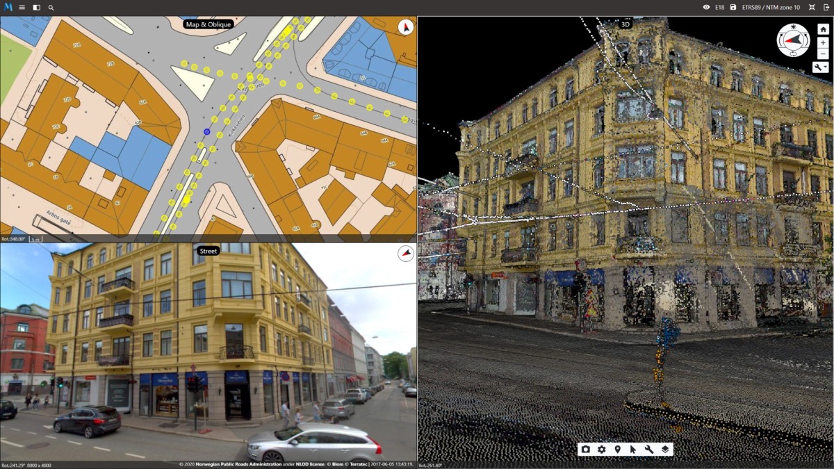
Multi Data View
Mapspace supports simultaneous work on multiple data sets. Explore your area of interest with Nadir, oblique, street or LiDAR perspectives. All viewers support importing external data sources like WMS/WMTS or local vector data to empower you.
Take data driven decisions in one space.
Try here!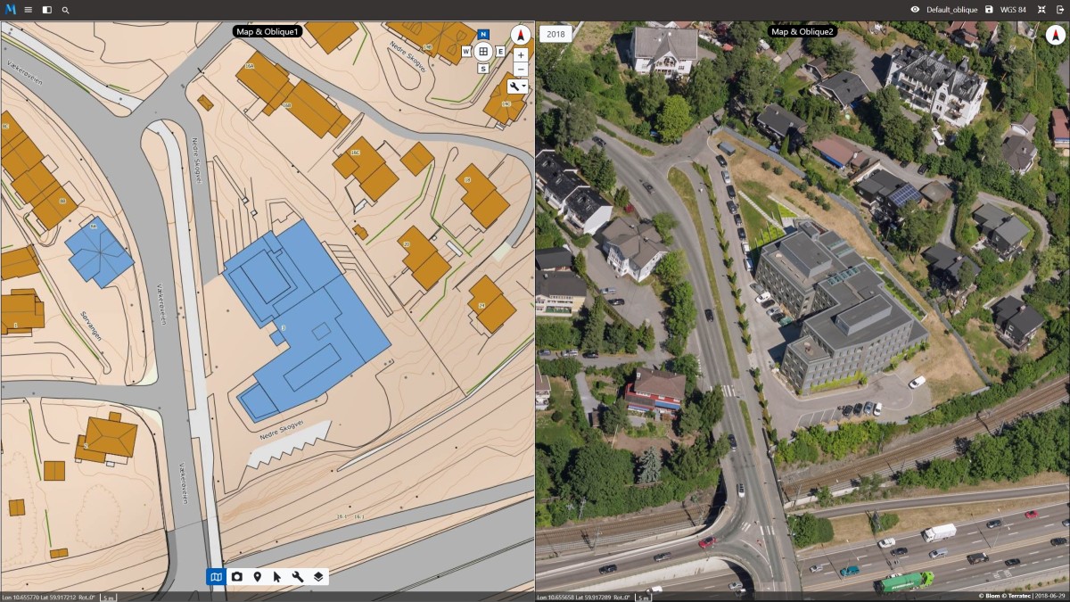
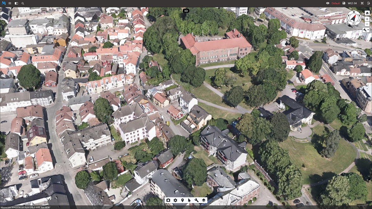
Map & Oblique
Navigate seamlessly through vast amounts of nadir and oblique imagery and freely explore all your available data with intuitive tools to view, measure, identify, annotate, share and export. Unlock the fourth dimension! With Mapspace you can effortlessly view and analyse changes in the urban landscape by comparing images from any year.
Try here!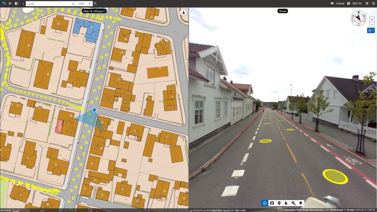
Street View
360° street view is a technology that provides interactive panoramas street positions, drone or captured indoors. It displays panoramas of stitched images, but in addition high quality depth maps are produced for each panorama so user can measure directly onto or collect coordinates of all visible objects.
The user is able to import their own vector data or load them from road database NVDB (for now only available in Norway).
Try here!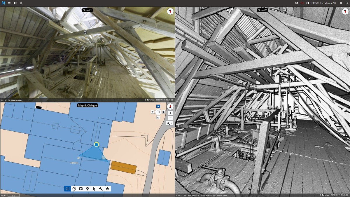
Indoor View
The same technology as in Street View is used but for indoor panoramas. The user can display multiple windows in viewer - all synchronized together so we see both image and depth information.
Try here!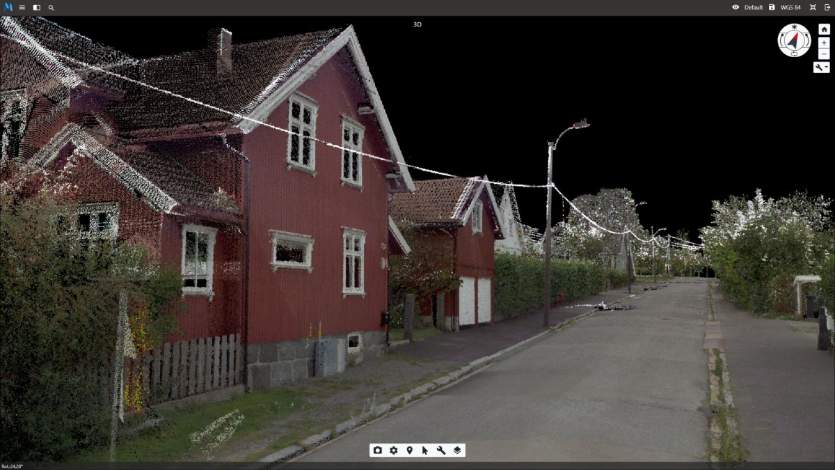
3D Laser
Unleash the potential of 3D data with our viewer. Explore millions of points in your web browser, with no plugins needed.
We invested a lot of time to optimize data streaming so you can see full resolution of your laser scanning data (LiDAR). You can display LiDAR data with RGB colour or select predefined LiDAR class. This viewer supports importing vector data and NVDB data (road database in Norway). User also has a toolkit for measurement, mapping, and annotations collection.
Try here!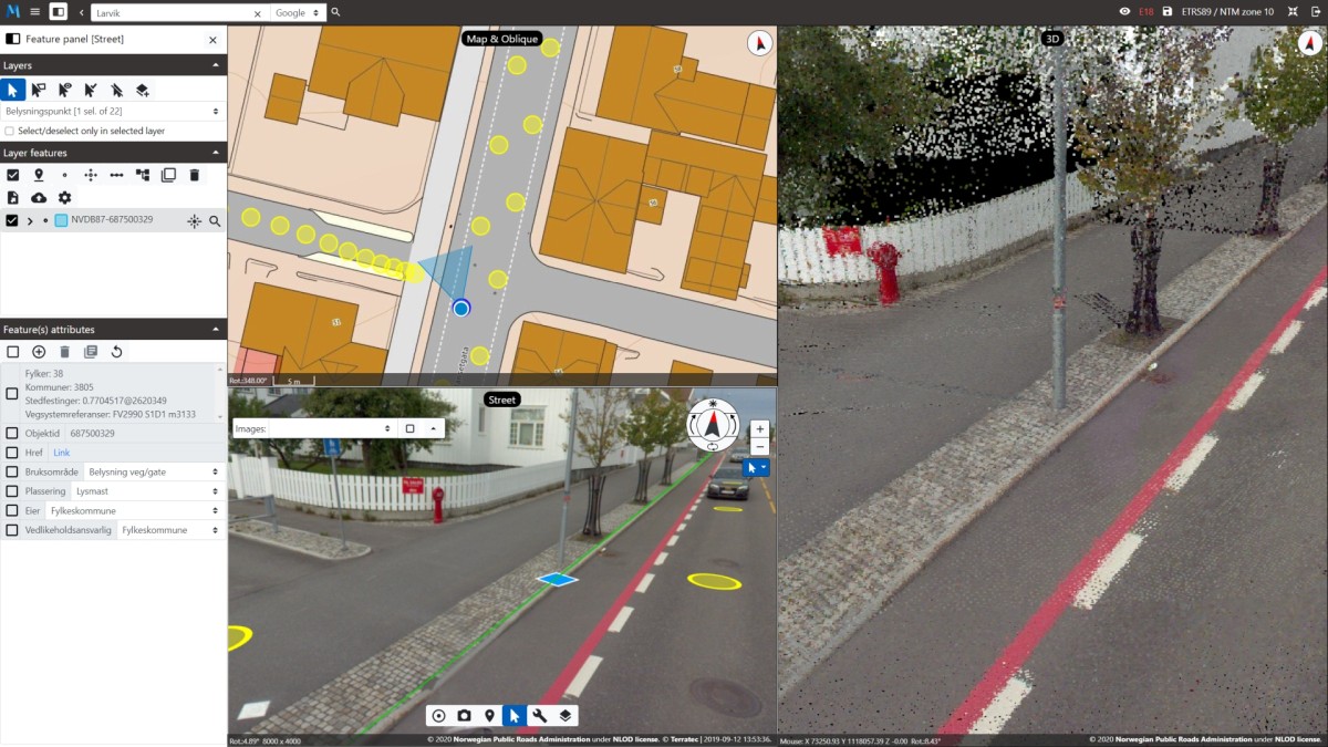
NVDB read/write
Data fusion is the process of integrating multiple data sources to produce more consistent, accurate, and useful information than that provided by any individual data source.
Therefore, we developed viewers to communicate with an external database. In Mapspace you will find full support in reading and writing to Nasjonal vegdatabank (NVDB) from Statens vegvesen (The Norwegian Public Roads Administration.).
3D Mesh Models
3D mesh models – Immersive photorealistic complex network of triangles textured with high resolution photos.
In our 3D viewer we support all 3D mesh models, those made with Aerial, Drone or Terrestrial imagery. No plugins required and you can do more than just see. There is full compatibility with our toolkits for measurements, mapping, and annotations.
Try here!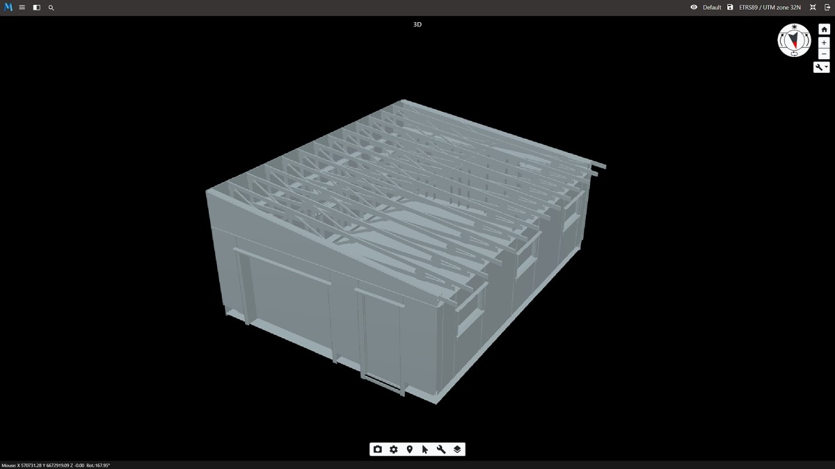
3D vector/BIM models
We made 3D vector data available for you in the web browser. 3D city models, 3D building models, BIM, explore it, compare, or overlay with other data sources. User has also toolkit for measurement, mapping, and annotations collection.
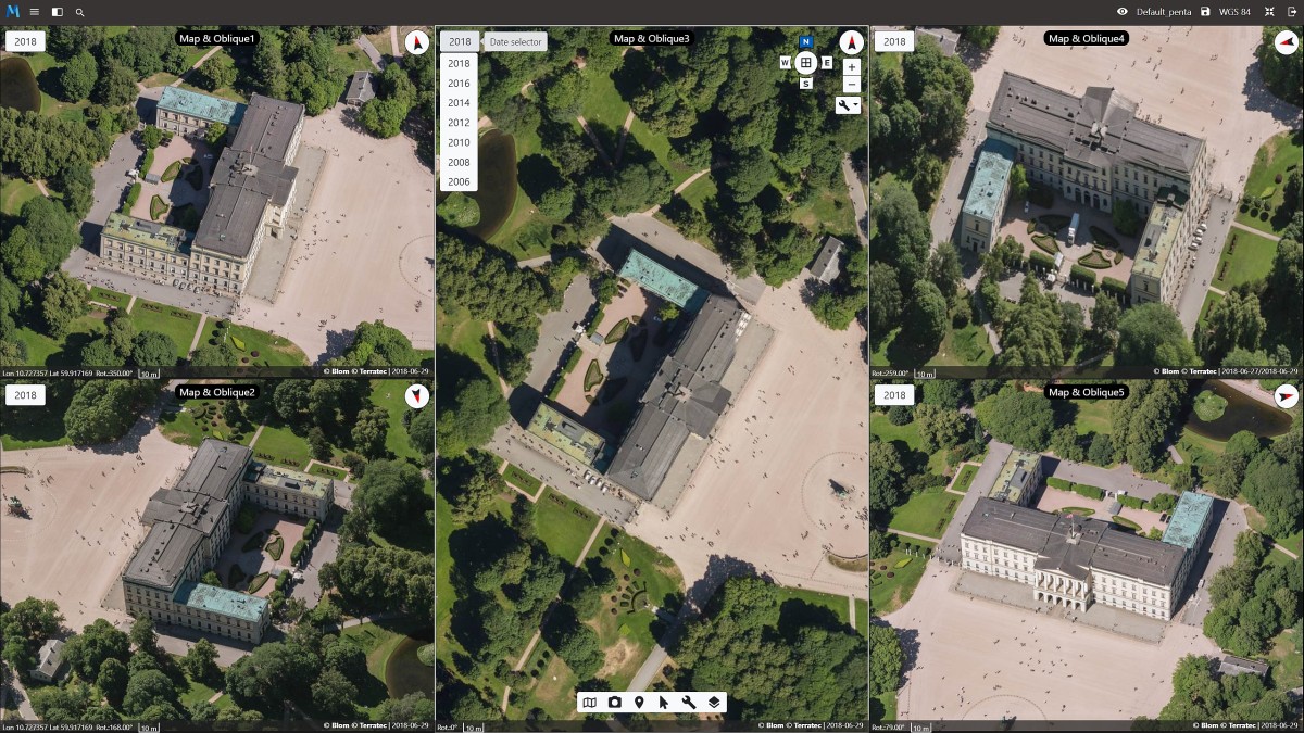
Penta Oblique View
Our Map & Oblique viewer supports a combination of multiple windows. We made pre-defined Penta workspace so you can explore your Map/Ortho and oblique imagery from all angles – all synchronized and responsive. All viewers will allow you to measure, draw and export your annotations. There is also an option to implement historical data sets and compare changes.
Try here!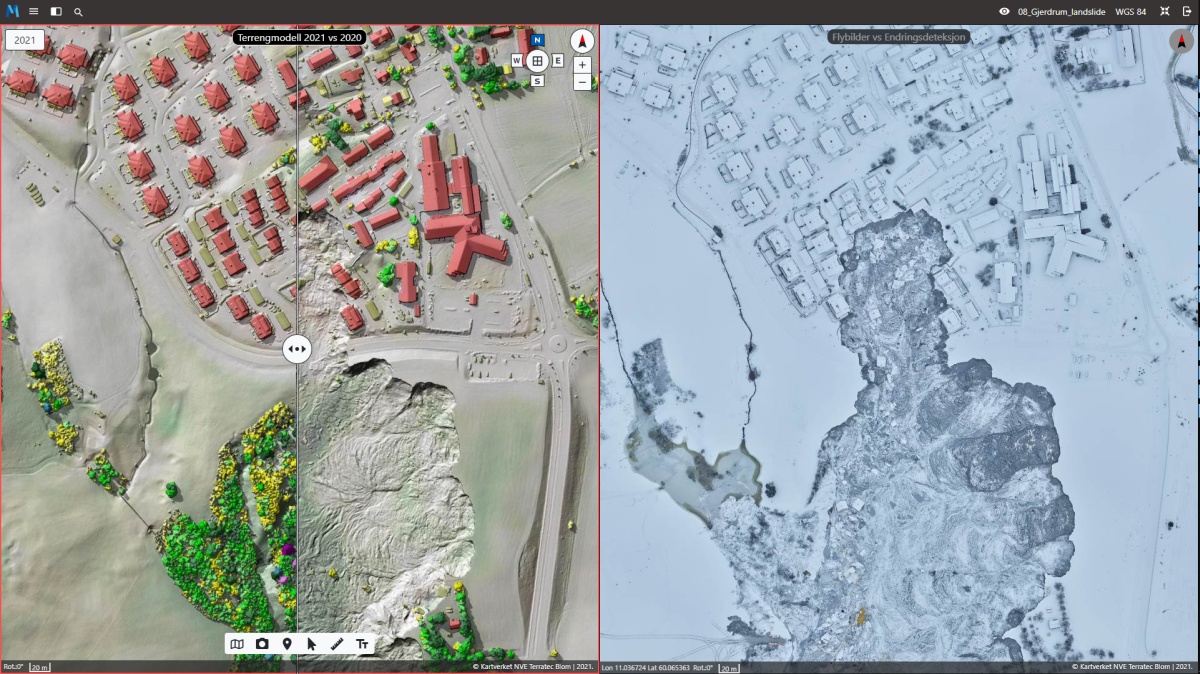
Gjerdrum Landslide
Field has visualized different types of geodata; laser data, orthophoto, oblique photo, DTM, DHM (surface model), 3D orthophoto / 3D mesh, change detection maps, and older available data for this area in Mapspace. Solution that shows changes in the terrain before and after the landslide tragedy at Gjerdrum, Norway. The display of the Gjerdrum data is open to everyone.
Try here!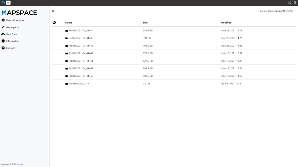
Cloud storage
Mapspace user has access to our cloud storage with their data, our simple productivity platform that keeps you in control. User can download files any time from our cloud. Powered by industry-leading, on-premises content collaboration platform. Your data is stored in our private cloud located in Norwegian data centre with high speed data latency and state of the art security level.
 is a geospatial web portal by